
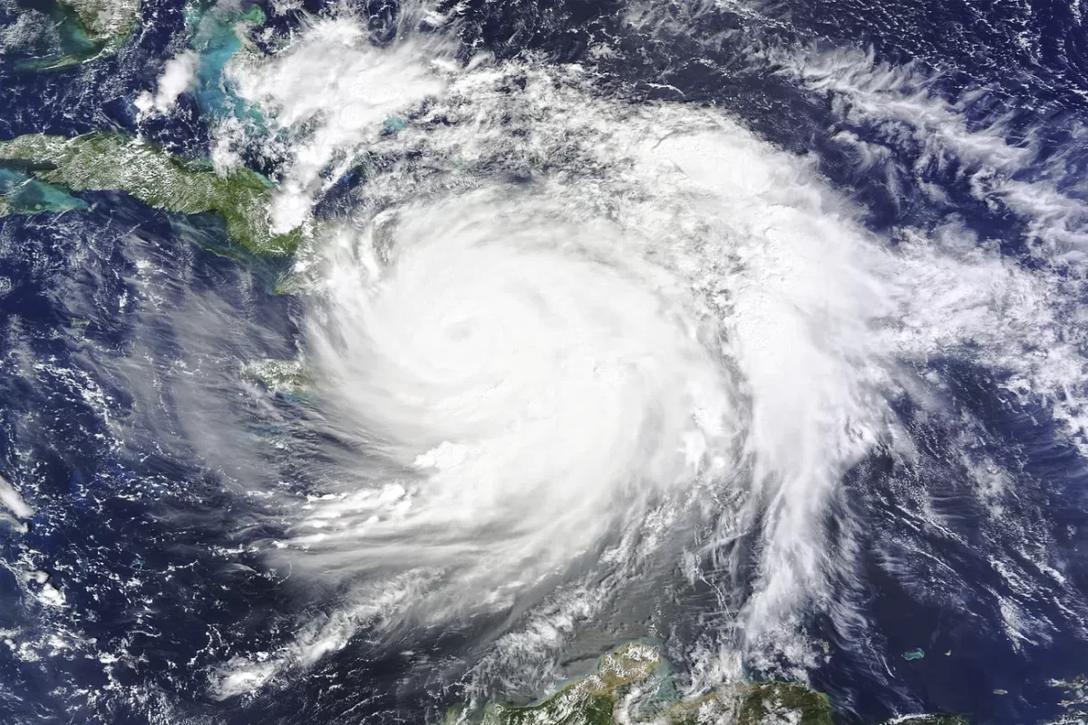
Earlier last month, a tropical storm made its way through California—the first time since 1997 that one entered the state, which is usually known for its dry conditions – and led to the first issue of a tropical storm warning in California’s history. Hurricane Hilary, as it was classified before making landfall, started off the coast of Mexico and Guatemala and made its way north to Baja California, Mexico after being downgraded to a tropical storm due to California’s hurricane-unfriendly climate.
But what makes this so unusual—and can more events like this happen in the future as a result of climate change?
California’s climate, influenced by Pacific wind and sea patterns, is usually good at blocking hurricanes from entering the state. The California current pulls cool water from Alaska in the north down along the Pacific coast of the United States, resulting in much cooler ocean temperatures along the coast of California than in other areas of the same longitude, hampering storms. In addition, the east-west trade winds help to direct storms away from the west coast.
“This is a place we’re so familiar with hearing about forest fires, drought conditions – not tropical cyclones,” stated Jill Trepanier, an associate professor at Louisiana State University, in an interview with NPR. Yet somehow Hilary still managed to break through and cause an estimated $600 million in insurance losses and $14 million in damage.
A mix of the current developing El Niño weather pattern, paired with rising global sea temperatures, has weakened California’s natural defenses to allow the storm to make landfall through conditions which otherwise would have subdued most hurricanes. El Niño, part of the Earth’s natural temperature oscillations that cause higher sea temperatures and air pressure in the Pacific for several years at a time, reduces the intensity of the east-west trade winds that help to push away storms and reduces the southward flow of cool water. This reduced movement compounded with the effects of greenhouse gasses – 90% of the heat generated by them directly affects surface sea temperatures – allows the coastal water to heat up to temperatures much greater than average. During this past summer, in addition to El Niño increasing temperatures in the Pacific, 48% of all oceans globally have been experiencing heat waves which can further provide essential warm water for strong storms. Along the equator, scientists predict that these Pacific heat waves will potentially last much longer than others have in the past. One just off the coast of California has been brewing for nearly a decade, increasing the temperature of the ocean off the coast by about 5.4°F above average. The trade winds over California helped to push the consequences of this away—until El Niño came.
El Niño, the lasting marine heat wave, and global warming trends leading to record Pacific Ocean temperatures all came together to form the perfect conditions to brew new strong storms, and to strengthen existing storms even more. Hurricane Hilary was powered by rapid intensification while it moved across the Pacific, reaching a Category 4 classification before weakening to a tropical storm prior to making landfall in Mexico. Fortunately, the storm caused less damage than expected after entering California. Cities around the state experienced a full year’s worth of rain, prompting flash floods and mudslides that forced various highways and schools to temporarily close. No significant damage was reported, nor were there any casualties in the U.S. Due to the significant rarity of tropical storms entering California, it is quite hard to make accurate predictions of the damage one would do to the state. Only two indirect casualties have been linked to the storm, both of which were in Baja California. Baja California experienced significant flooding and landslides, causing thousands to be evacuated to shelters.
After Hurricane Hilary, more unexpected events like this may be expected in the future. Hurricane Hilary was just one example of how our changing climate could impact storms around the globe—however, it alone is not complete proof of drastically changing weather patterns. Climate change would rather impact the frequency of these extreme weather events, so California and other typically dry regions could start seeing more intense storms in the future as a result. The exact effects of climate change on storms in the Pacific and what to expect is still unknown as these events happen so infrequently, but that may be changing.