

Go Take A Hike!
The Osho Loop Trail in the Sandias offers views, fresh air, and a respite from the heat
Quinn Ennis
Albuquerque’s high temperatures the last few weeks have meant that hikes in the bosque and foothills are less fun without an early morning start. To escape the heat, I turned to the higher and greener side of the mountain. I decided on the Osha Loop hike, which I thought would be relatively free of other hikers. The whole hike was approximately eight miles long with 1,500 ft of elevation gain. As long as the weather is cool, it is easily completed in around 3 hours.
The crest road (NM Route 536) is an adventure in itself. The hairpin turns and breakneck motorcyclists necessitate focus, attention, and a pre-drive cup of coffee. From highway 14, the crest road winds for about 11 miles before reaching the 10k trailhead. I had hoped to escape the crowds by going high up on the mountain, but almost every spot in the parking lot was full by my late 10:30 start.
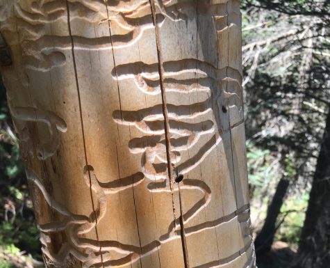
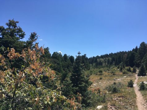
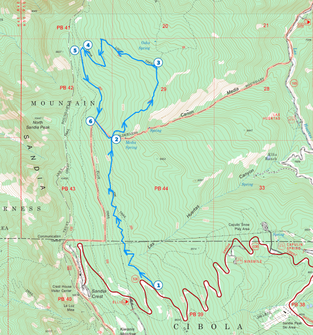 The 10K trail starts out at around 10,000 feet heading north and the first 1.5 miles are fairly flat (1). The trail works its way between large fir and spruce trees. The trail is very well maintained in this section and the limestone and roots make for easy stair-like features on downhill sections. Around mile 1.7 the trail opens into a large meadow and begins to descend. Due to the tall surrounding trees, the meadow did not provide the views I had hoped for, but the grasses and few flowers were nothing to raise one’s nose at. This meadow slowly transitions into an aspen grove with fallen logs next to the trail. Many of these logs carry the distinct markings of wood worms, which carve intricate paths under the bark while the trees are alive.
Around mile 2, the 10k Trail intersects the Osha Loop Trail (2). Turning to the northeast and following the loop counterclockwise, the trail runs downhill steeply. The next 1.3 miles descend almost 1,000 feet and the deciduous trees give way to gamble oak. While this section of trail is slightly overgrown, it is relatively easy to follow and I encountered no other people. After this steep descent, the trail levels out for a few hundred feet before Osha loop turns to the west (3). Osha Spring Trail continues north from here, but it makes for a significantly longer hike.
After about .5 miles and 300 feet of climbing, the trail takes a switchback to the south followed by two more switchbacks in the next 0.8 miles. This section is fairly steep, but the lack of people and scatterings of wildflowers make it worth the work. At the third switchback, the trail appears to continue forward, and here is an easy spot to make a navigational error (4). I pushed through bushes for about .3 miles before turning around. When I got back to something that could be positively identified as a trail, I discovered that Osha actually took a sharp turn to the southwest and climbed back up the hill. This turn is not obvious and the trail at first seemed like an animal track.
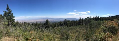
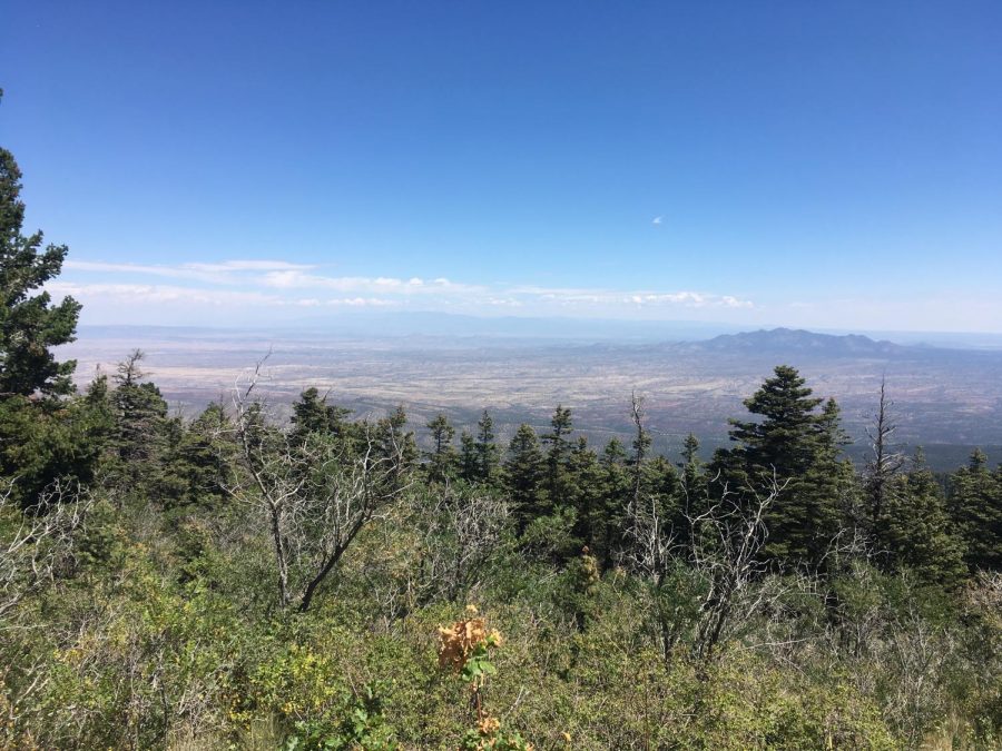
A few hundred feet after the third switchback, the trail intersects Ellis Trail (5). I decided to take Ellis as it provides better views on that leg than Osha. If you choose to take Ellis at the intersection, take the trail that runs a little east of south. Just a few hundred feet down Ellis, the trail opens up onto a meadow that provides the best view of the hike. The view here is worth stopping for as the vista stretches from South Mountain in the northeast to the Manzanos in the south. In the next mile, the Ellis Trail rises just 800 ft before intersecting the 10k Trail again (6).
At 10k, I made the mistake of turning to the northwest, which again branches out into a longer loop. After less than .3 miles I turned back, but you can continue further just another .5 miles to the Del Agua Overlook, which provides views of the city to the west. If you take the correct turn onto 10k to the southeast, 10k will run steeply downhill for about .25 miles. This returned me to the spot I first turned onto Osha. The next 2 miles take you back on the same trail as the first 2 miles of the hike.
Quinn Ennis ‘22 occasionally wrote for the Advocate from 6th grade through 10th grade but began to approach journalism more seriously during the pandemic...